Using Aerial Imagery to enhance farm productivity was once out of reach, but it is now much more accessible on a timely basis for an affordable price. When you hear phrases like Color Infrared (CIR), Normalized Difference Vegetation Index (NDVI) and thermal imagery it may conjure up some forensic type of scientific data analysis that only a PhD could do, however, it is very much the opposite.
In today’s world, aerial imagery can be delivered from weekly flights by next day. This provides images that map out where vigor and stress are, where water is evaporating, and show whatever can be seen from the air. Growers can view and share imagery directly from the web. An aerial view empowers the grower to make decisions based on current knowledge of his fields as a whole. The information provided by these images can lead to improved vineyard health and profitability in many ways, but in the shadow of the drought where water is difficult to come by, I’d like to discuss how it can improve irrigation efficiencies in particular.
__________________________________________________________________________________
TerrAvion provides CA growers with agricultural aerial imagery service. Information about TerrAvion, their services, and how aerial imagery can be used to inform vineyard management decisions see their website at www.terravion.com.
__________________________________________________________________________________
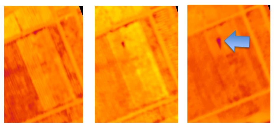
Figure 1:Thermal view of progression of irrigation leak at the UC Davis V&E Department vineyard from of May 1st to May 15th 2014.
Irrigation Leaks and Plugs
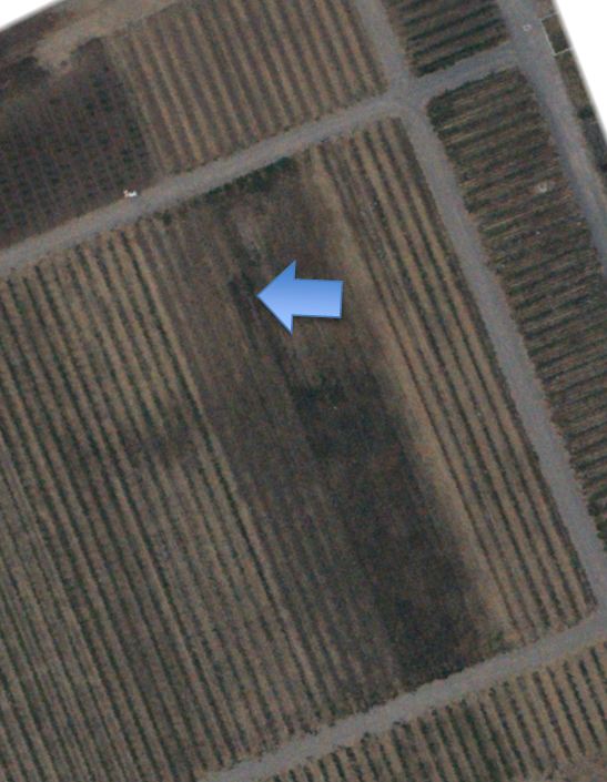
Figure 2: UC Davis V&E Department Vineyard May 15th 2014, Soil Discoloration From Leak Evident
While every grower does things their own way, many send an irrigator down every row of a vineyard to check for leaks of plugs during an irrigation event. By looking at a thermal aerial image of the field you can identify leaks. They will show up as a colder spot in the field as the excess water is causing the area with the leak to drop in temperature compared to the rest of the field. See Figure 1. While the leak is easiest to spot in a thermal image, it can also be seen in a normal color photo. See Figure 2.
If a leak goes untreated, it will eventually show up in an NDVI photo. A leak will result in excessive vigor in the area affected by the leak. In Overview’s current NDVI scale this shows up as an area of dark blue. See Figure 3.
The Bottom Line
There are validated financial benefits of using aerial images to increase vineyard profitability. These start with increasing irrigation efficiency, but include countless other moneymaking or money savings practices.
For More Information feel free to contact me, Sarah Risorto, Operations Director, CCA, PCA, at TerrAvion: 925-319-7913 or sarah@terravion.com.
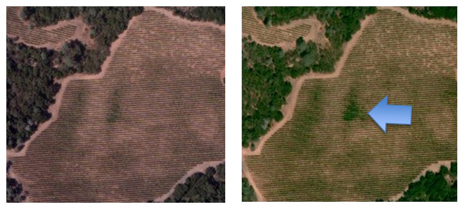
Figure 3: An uncorrected leak will blow-up the canopy as some vines get water intended for others as seen in this Sonoma County Vineyard in July of 2013.
